
It’s 10:36pm, and I’m travelling through Yorkshire on a train to London.1 We should have arrived nearly half an hour ago. Our first train was cancelled before we got to the station, and our second train was cancelled at Doncaster. We do have seat reservations in one of the front coaches of the train, which rather appropriately2 means we’re in L.
I’m hoping that train number three will make it all the way, or at least to some point south of the East Midlands. In the meantime, I thought I’d while away the journey by writing a blog post; specifically, the next instalment of my series about a journey that was somehow more senseless than the one I’m on at the moment. So, without further ado…
Last time: for the first time, I’d had to cheat because a borough didn’t have any sort of sign that fit the bill for this self-imposed “challenge”. I then spent a rather boring hour traipsing through north-west London to tick off a few more. For some reason I decided to press on with going to some more.
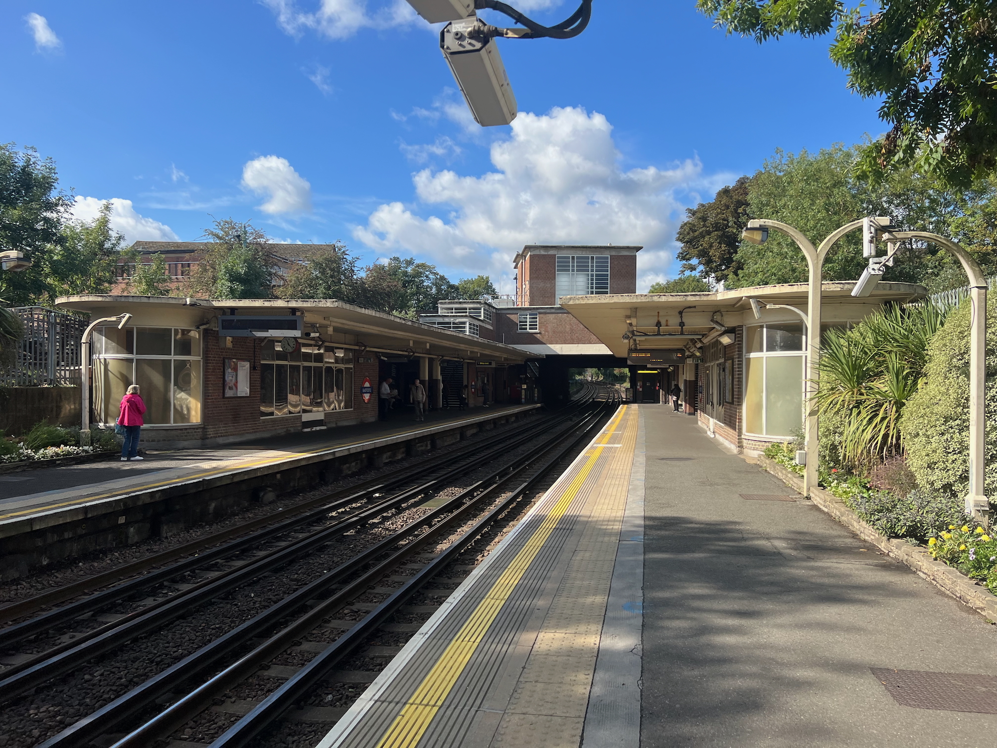
Lacking a convenient train to get back into central London from the Hillingdon sign, I had to resort to a bus to take me to the nearest tube station.3 This led me to the rather beautiful Eastcote station on the Metropolitan line—shown in the photo at the top of this post—which was designed (in its current form) by the architect Charles Holden. Holden is perhaps best known (even by people who aren’t me) for his work on the Underground—if you see a station that looks vaguely art deco, it’s probably one of his. But as I was researching this I found out that he also designed the Senate House of the University of London, the building which George Orwell had in mind when he described the Ministry of Truth’s headquarters in Nineteen Eighty-Four. I’m telling you all this because at the time I was laser-focused on getting the selfies and had no intention of writing a series of blog posts about any of this, because the blog was dormant at the time, so there’s really little else to say.
The Tube took me to Willesden Green, where I found my Brent sign.
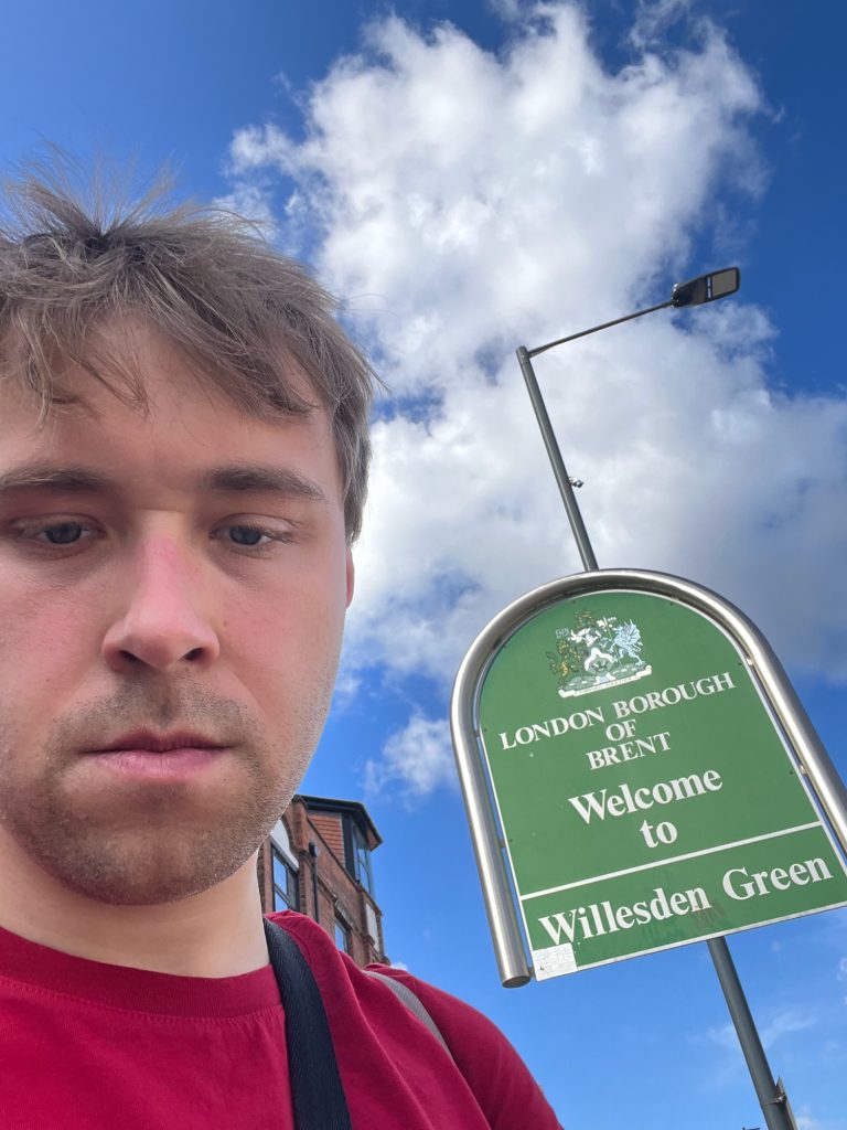
This one’s a bit of a puzzle, to be honest with you. Brent didn’t have many signs; the one I did find, on Willesden Lane, isn’t particularly near any of the borough boundaries, or indeed anything that means it’s likely to be your first encounter with the borough. My guess is that Brent once had signs welcoming you to various of its local centres—something Tower Hamlets once did—and this sign is one of the survivors. Either way, one more ticked off.
The sign wasn’t particularly near the boundary, but nor was the boundary a huge distance away. So it was after only a quarter of an hour’s walk that I bagged my next one, for Barnet. And this one’s a bit of a puzzle for a different reason.
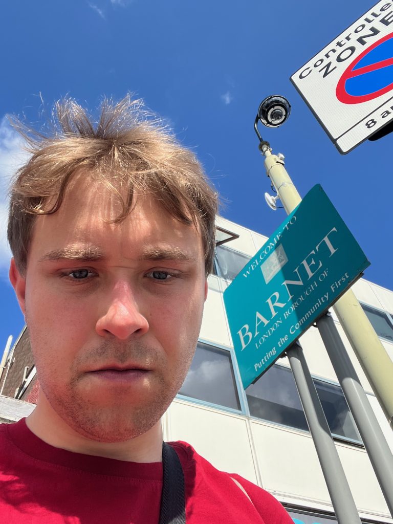
I really can’t work out why the sign is written in that order, with “London Borough of” after the borough name. Is that part of the tagline: “Barnet, London Borough of Putting the Community First”? The spacing would suggest otherwise. So did they just stick the “Barnet” bit on too high, and then put the other words after instead to fill the space? Seems implausible. Maybe the sign was just written by a librarian, who wanted to promote good indexing practices for when the time came to take the signs down and put them in an archive somewhere.4 Whatever the reason, it’s hard to be sure because Barnet has rebranded since this sign was made—it now seems to identify itself as “Barnet, London Borough”, which honestly just gives more credence to my librarian theory.
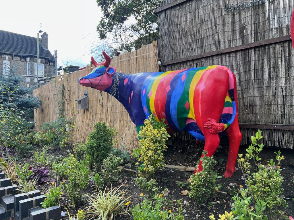
I then proceeded to Hackney for my next sign. Between sign selfies, I took precisely one photo, which from the timestamp and geotag must have been very close to the Barnet sign. Here it is:
On to Hackney. From memory, I did this by getting a Thameslink train from Cricklewood, which I took one stop south to West Hampstead Thameslink, then I went to one of the other West Hampstead stations next door5 and got the Overground to my next sign. The line I took is, these days, known as the Mildmay line, so it seems rather fitting that my phone has labelled this photo as having been taken in Mildmay itself:6
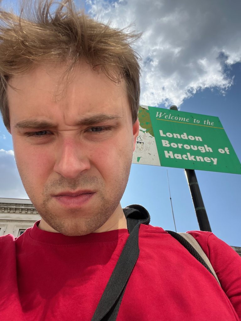
This one is a true rarity. As far as I know, it is the only “Welcome to the London Borough of Hackney” sign in existence, anywhere in the world—although I suppose for the vast majority of the Earth’s surface that’s hardly surprising. It took a fair bit of what I will self-aggrandisingly call “detective work”, and what you could more accurately call “faffing about on Google Street View”, to find it: while images exist online, nobody seems to have precisely identified its location. For the benefit of anyone who wants to repeat this exercise,7 I’ll save you the effort I went to—it’s on Balls Pond Road in Dalston, near its junction with Kingsland Road, and a very short walk from Dalston Junction station.
The proximity of Dalston Junction was convenient, because it allowed me to go directly to my next destination. This was somewhere actually interesting—a genuine tourist destination, no less—that I can tell you about without having to grasp around for vaguely interesting things to say. And that, naturally, is why I’ll be saving it for next time.
To be continued…
London borough count: 22/33
London borough count without cheating: 21/30
- It presumably isn’t, of course, when you read this—although that would be an incredible coincidence if so that you should tell me about. ↩︎
- Frequent flyers on the East Coast Main Line may be aware that coach L on LNER is a first-class coach; indeed, as I finished typing that very sentence I was offered a complimentary cup of tea. Such readers may therefore, quite fairly, question the appropriateness of that pun. ↩︎
- Which, honestly, sounds pretty good right now. ↩︎
- This is mostly a joke, but not entirely, because there is a factor like this that you have to be aware of when handling Scottish council area data. The rule for the 31 councils with official names in English (i.e. not Comhairle nan Eilean Siar) is that you get the council name by adding “Council” to the end of the name of the area. That means that the four areas with the word “City” in their name are “Dundee City”, “Aberdeen City”, “Glasgow City”, and, er, “City of Edinburgh”. It always irritates me just a little when this means that Edinburgh gets alphabetised under “C”. ↩︎
- This has got to be one of the silliest bits of transport infrastructure in London. There are three stations called West Hampstead—technically, one of them is called “West Hampstead Thameslink”, but given that the others end up being “West Hampstead Overground” and “West Hampstead tube” anyway that extra word might as well not be there. They’re all within about 200 metres of each other on West End Lane. There is no internal interchange between them. Edgware Road, eat your heart out. ↩︎
- The line was actually named, not for the district itself, but for the Mildmay Hospital, honoured for its pioneering treatment of people with AIDS. It traces its name to a religious institution based in Mildmay, the district, but the hospital itself is and has always been in Shoreditch, much nearer the present-day Windrush and Weaver lines. ↩︎
- Why, though? ↩︎
Leave a Reply