

Hmm, how do I feel about this post? On the one hand, I said that I wouldn’t encourage people to travel for as long as there was a pandemic. On the other, government advice is that travelling is fine, at least in England. (Here in Edinburgh we’ve been asked not to leave the Lothian region, and most people in Wales are legally prohibited from leaving their council area.) And this place has a tenuous link to the pandemic, so it’s topical. Probably.
Date of trip: too many to count
But I would like to recommend this place, and so I’m going to do it on certain conditions. If you live in or near Oxford, and as long as the advice doesn’t prohibit travelling outside Oxford itself, I think this is about as low-risk a way to get out of the city as you can get, if you walk there or travel by private transport. If you don’t live in the area, or if you don’t feel able to walk there, or if there’s a semi-lockdown like the ones in Scotland and Wales, please stay away.
So Shotover is managed by Oxford City Council, but the majority of it technically outside the city itself (which is why you shouldn’t go there if you live in the city and are restricted to travel outside). According to the Council’s page on the site, they started managing it in the 1930s; before that it was a royal hunting ground, and then farmland. That page also tells you how to get there; it’s outside the ring road between Headington and Cowley, and there are bus routes that go vaguely nearby—but, like I said, please don’t use the buses at the moment if you don’t need to.
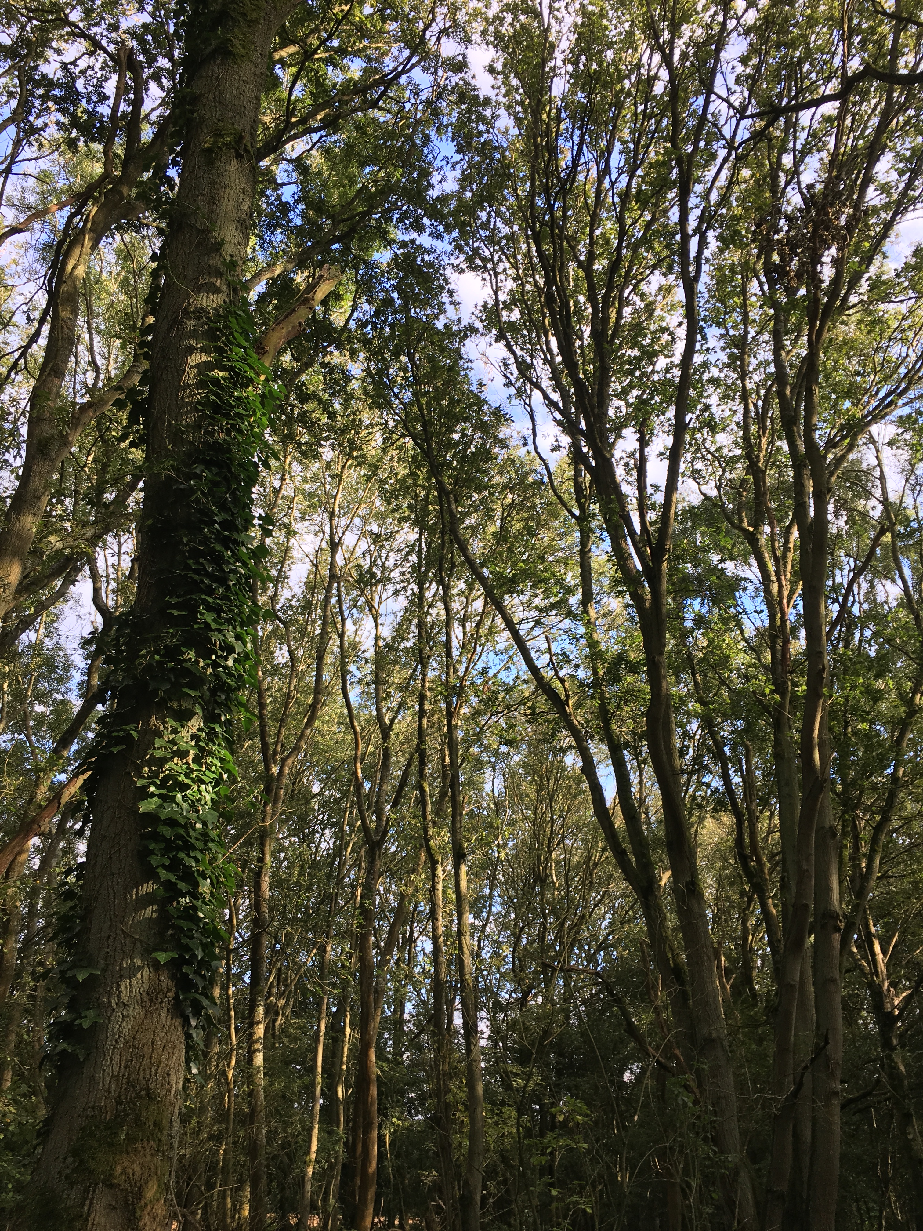
Why am I recommending you go there? Because it genuinely doesn’t feel like you’re anywhere near Oxford, so it’s an excellent escape. The landscape is mostly wooded hillside, with occasional plains and fields, and the odd stream. There isn’t much to do when you’re there but walk, granted, but that’s true in most of the countryside. Though this bit of countryside is a Site of Special Scientific Interest.
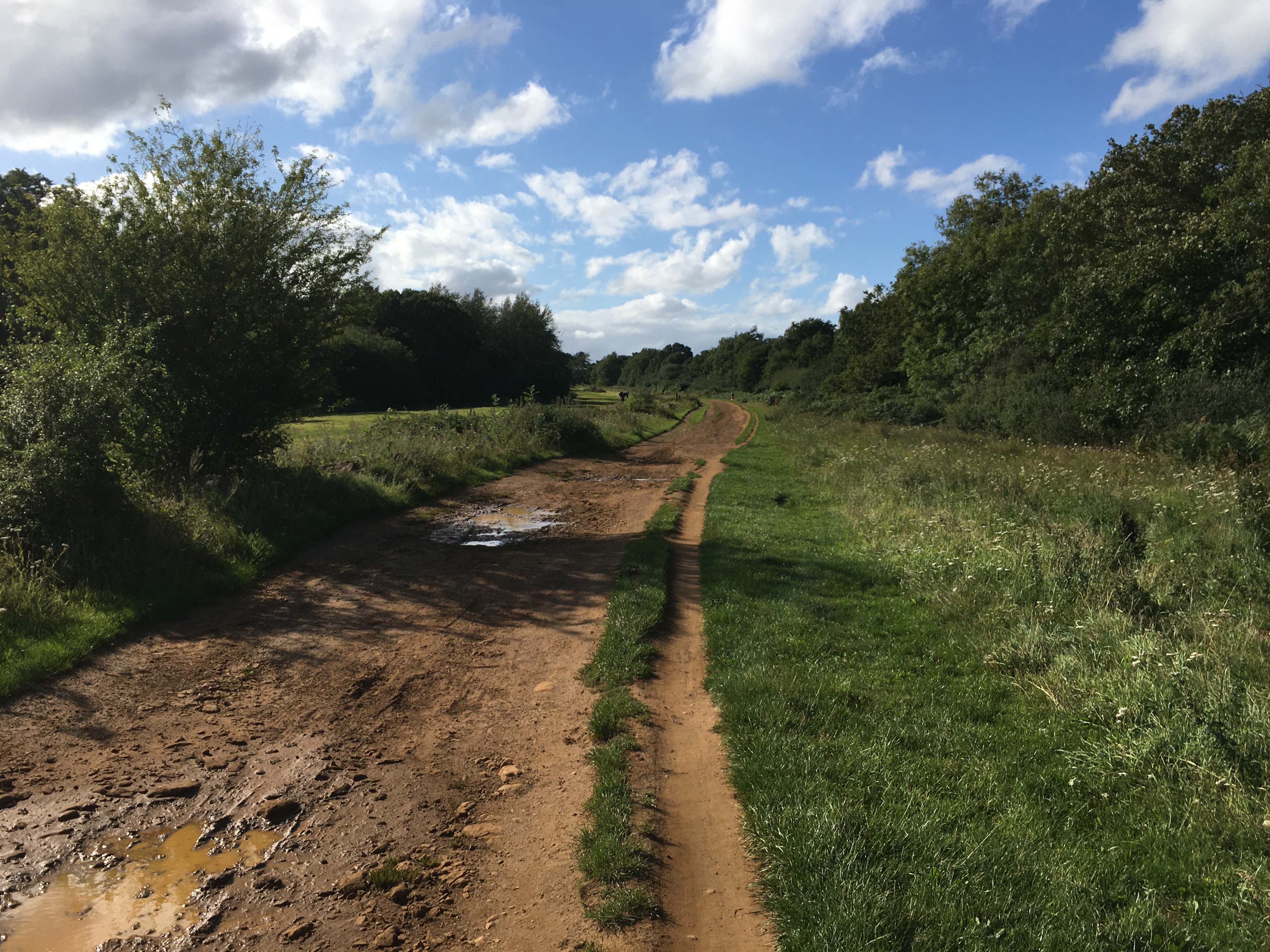
What you can do is follow one of the three colour-coded circular walks around the site, which all converge on the car park at the top of the park. These are marked out by little wooden posts with a red triangle, a yellow circle or a green square on them—well, I say “marked out”, but some of the markers have rotted away or (more likely) just been kicked down or stolen, so sometimes it’s not entirely clear which route the path takes, and I’d recommend taking a picture of the map at the upper car park before you set off.
Even the map, though, doesn’t give you the crucial bit of information you need for the coloured paths, which is that they only go one way around. This isn’t obvious at the start, because in parts they are marked in both directions. But then if you picked the wrong way at the start, the signs run out, and you have to try and deduce whichever way you’ve picked from the signs going backwards. So, for reference: the red route goes clockwise, and the other two go anti-clockwise, as the online leaflet confirms.
The red route, called the “Sandpit Walk” takes you on the shortest route around the upper middle of the park, through mostly woodland, though it eventually reaches a clearing known as “the Sandpit”, which is (shockingly) sandy, with a small stream that (as best I can tell from the OS Maps app) eventually flows into the Thames at Sandford. It’s a short walk, and though some of the hills are relatively steep (as on all the walks) it’s not too challenging, and probably won’t take you more than about half an hour, if that.
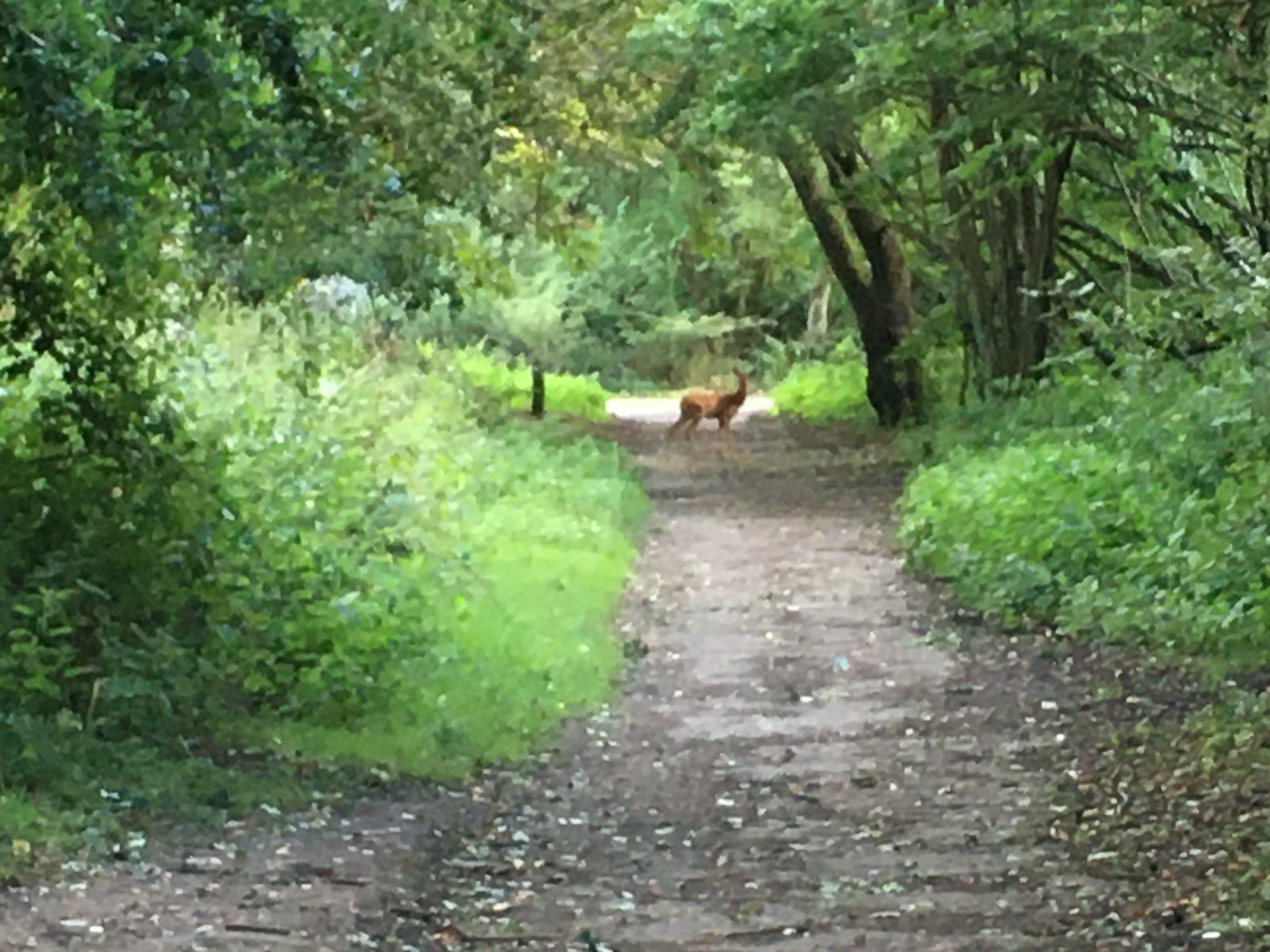
The longest walk, meanwhile, is the green route, “Boundary Patrol”. This roughly follows the edges of the park, which means it’s the only one of the paths to penetrate into Brasenose Wood, at the lower end of the site. (As the name suggests, the college once owned the wood; the excellent Headington History site has a comprehensive history of the site and its neighbours.) The wood is easily the least hilly bit of the park, and so perhaps the greenest; it is also home to deer (confirmed—at least one could be found there, anyway). The whole walk takes about sixty to ninety minutes, and does include some sections of relatively narrow and steep path at the Horspath Common end of the site—which isn’t great for social distancing if someone is coming the other way.
But my favourite path is the one that splits the difference: the yellow “Northwood Trail”, which takes 30–45 minutes. Again it sticks to the main wood, avoiding the western Brasenose part, but it covers a lot of varied terrain: hillside, dell, field, brook. It’s also relatively decent for staying away from people, because (once you get to know it a bit) there are usually nearby bypass paths you can take.
So what’s the tenuous link to the pandemic? Well, the top end of the site with the car park is reached by a narrow, steep road (which, halfway up, changes from a 30mph limit to 60—if you’re driving there, please don’t take this as advice to accelerate). That road is, in fact, Old Road, which runs all the way from Gipsy Lane (near Brookes) to the village of Littleworth to the east of the city. It is so named because it was the old road to London, and the council’s information page tells me the part through Shotover was once a favoured haunt of highwaymen.
At the Oxford end of Old Road, however, you’ll find the Old Road campus of the University of Oxford, home of the Jenner Institute—if you’ve heard about the potential “Oxford vaccine” against COVID-19, this is the part of the university that’s responsible. So if that vaccine works out, you have, in a sense, a part of Shotover Country Park to thank. Maybe.
Leave a Reply